|
Chapter 12
Location, Location, Location
The decision that Caty Todd and James took to move to
Kentucky would forever change the way in which the Ware family tree would grow.
The taproot may have started in Virginia, but branches were now popping out in
the good, rich soil of Kentucky. Of course, one
could always argue that Kentucky was once Virginia anyway, but it spoils the
imagery.
As Webster�s dictionary explains it,
�A taproot is an enlarged, somewhat straight to tapering,
root that grows
vertically downward. It forms a center from which other roots sprout laterally.�
There was
still a large group of Wares in Virginia, but those �other� roots were now
firmly growing in Kentucky and would prove to be equally as hardy and prolific.
Cornelia
wrote, �I have been told that the Wares are very influential and wealthy in Kentucky.�(Ref. 2)
She was informed correctly. A large part of
the success of the family in their new home came as a result of having good
property locations.
Water was an essential attribute, but the soil and
topography of the land also contributed to its richness.
The fact that James lived around the Lexington area was of major importance. �Geographically, the location of Lexington was fortunate in that the town became
the transportation hub of the state. Nearly all the
early Kentucky trails and roads passed through or near this settlement.
Commerce going to and from the surrounding settlements, except that which went
by river, passed through Lexington. Not only was
Lexington the highway focus of the state but it likewise became commercially the
�queen city� of the West, a position it maintained until 1818 when Louisville,
as a river town, began effectively to drain it of its commercial resources.�
(Ref. 2254)
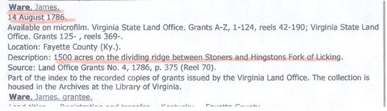
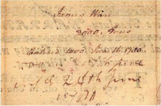
We know that, as of �August 14, 1786,
even prior to the move, James owned 1500 acres on the dividing ridge between
Stoners
Hingston�s Fork of Licking.�
(Ref.948)
This was purchased and filed through
the Virginia Land Grant Office. (see below)
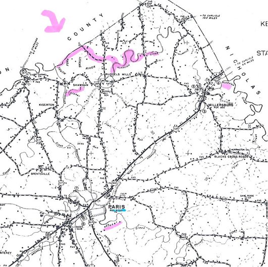
Map showing
Hingston�s Fork of Licking and Stoners Rivers
It would not be the only property he would own, though.
On October 13, 1797, there was an Indenture (large
legal contract entirely written by hand)
�for James Ware of Fayette County to Clifton Rodes of the same
county for 27 pounds, for 17 acres in Fayette County on David Jones� Fork of
Elkhorn, joining the tract whereon the said James Ware now lives and bounded by
Ashby�s line.
Absolem Adams, George Northcut, and Jesse Barbee witnesses,
recorded December 11, 1797.�
(Ref. 1077, 1091)
In May of 1779,
the Virginia General Assembly had passed laws that expanded the land patenting
process to include acquisitions by Treasury Warrants.
From October 1779 to December 1783, over 23,000 of these Treasury Warrants were
purchased from the Virginia Land Office or authorized by the state General
Assembly by special legislation. There were four
major steps required in obtaining land ownership. You needed the
actual �warrant� which would authorize a survey, the entry number reserving the
land for patenting, the field survey done by �a regularly appointed County Surveyor,� and finally, the �Governor�s Grant� or signature which
would seal the deal.
The surveyor needed the following information to do
his job: �. . . the proposed boundary in
numbers of acres, on some particular watercourse, and in one of the original
counties.�
(Ref. 2284) It was possible for a person to have several warrants in
their possession, but unless the other three criteria were met, the land was not
legally theirs.
The recipient of the warrant also had choices
regarding disposition of the land. In the case of
one man, he was awarded over 15 warrants, but he chose to patent only 11 of
them.
He probably just sold off the other parcels if they did not
benefit his estate.
The following is a description of the job of the
surveyor:
�The job of a surveyor in the eighteenth century was to
measure land to be transferred
from the crown to private ownership.
When a warrant was issued from the secretary of state's office in Williamsburg,
the county surveyor would survey the designated tract, draw a
plat (a map showing the features of the land), and write a description of the
land.
Most surveyors learned their trade through an
apprenticeship.
County surveyors were appointed.
Both surveyors and chain men (those who held the measuring chain) had to take an
oath that they would be faithful, accurate, and would record their results
without favor.
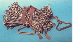
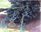
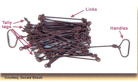
During the 1700s and 1800s, Gunter's chain was the standard
for measuring distances and played a primary role in mapping out America.
The chain consisted of 100 links and its total length was 4 poles (66 feet).
Each link was connected to the next by a round ring. Eighty chains
equaled one mile. Because the chains were hand-made, their measurements were
rarely exact.
Gunter's chain served as the basic surveying instrument for
three hundred years, until it was replaced in the early 20th century by the
steel tape.�
(Ref.
2273)
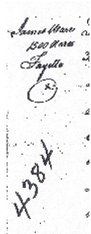
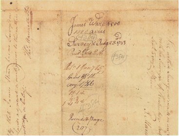
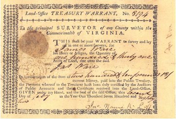
Survey chains
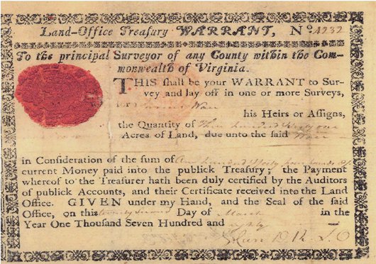
Land Warrant dated March 22, 1780 for
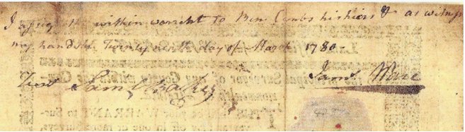
On the back of
the land warrant 4234
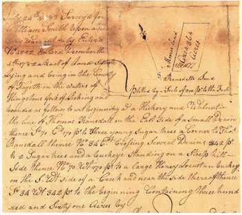
Survey for warrant #4234
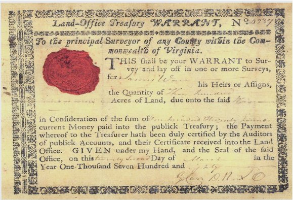
Land warrant dated March 1780 for
Survey on the back of warrant #4232
Land warrant dated March 22, 1780 for
Back of warrant #4327
Survey for Warrant #4327
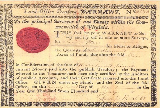
Although only the front part
of this Warrant # 4384 was available for copy, the registration number and
survey note tell us that it was for 1500
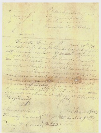
acres of land and the survey was done in 1783. Governor Patrick
Henry signed the paperwork.
Final paperwork signed by Governor Patrick Henry
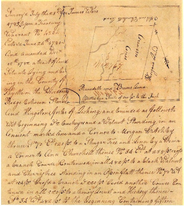
The following is a transcription of the above document and
other surveys which describe the location of the land James Ware purchased.
�Patrick
Henry, Esq., Governor of the Commonwealth of Virginia, to all to whom these
present shall come, greeting - Know ye that by virtue and in consideration of
part of a Land Office Treasury Warrant No. 4336 offered the 22nd Day of March,
1780 there is granted by the said Commonwealth unto James Ware, a certain land
or parcel of land, consisting 1,400 acres by Survey bearing date the 23rd day of
July 1783, lying and being in the County of Fayette on the dividing Ridge
between Stoner�s and Hingston�s Forks of Licking and bordered as follows � to
and beginning at 2 Buckeyes and a Walnut standing in an ancient marked line and
a corner to Morgan and Ashby, thence South 70 degrees east, 520 poles to a
Shugar Tree and Line by a Drain a Corner to Ann Churchill, thence North 34
degrees East at 238 poles crossed a branch course - continued in all 482 poles
to a black Walnut and Cherry tree standing in an Open Flatt � thence North 70
degrees West and 154 poles crossed a branch at 220 poles crossed another Course,
continued in all 520 poles to a Honey Locust and Hickory � thence South 34
degrees West
to 282 poles to the Beginning with its appointments to have
and to hold the said tract or parcel of land with its appointments to the said
James Ware and his heirs forever. In witness
whereof the said Patrick Henry, Esquire, Governor of the Commonwealth of
Virginia hath hereto set his hand and attached the Proper Seal of the said
Commonwealth of Virginia to be affixed at Richmond . . .�
This particular
land was bordered by Randall�s and Brown�s land on one side, Morgan�s land on
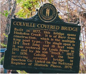
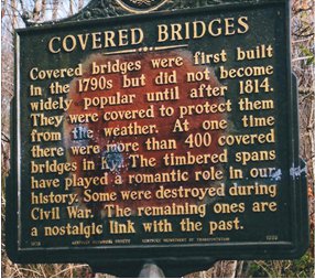
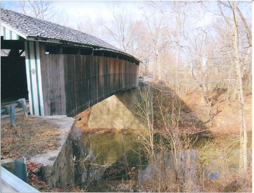
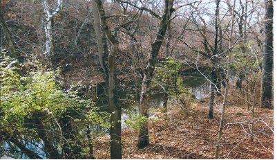
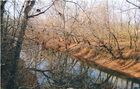
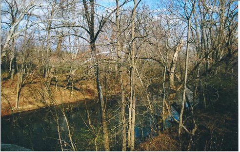
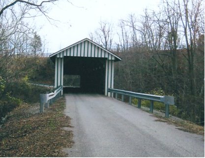
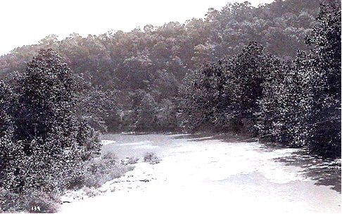
another, and Ashby and Churchill�s on the third side. Hinkston Creek
Covered Bridge crossing over
Hinkston Creek
All photos taken by James and Judy
Ware - 2010
Hinkston Creek
Hinkston Creek
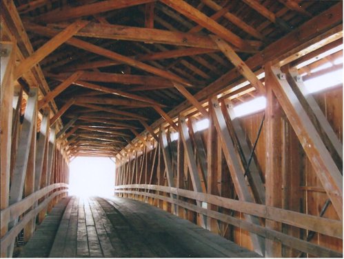
Covered Bridge over Hinkston Creek
Inside the bridge
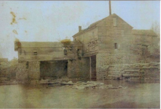
Old Mill on the North Side of
Hinkston Creek
Land warrant dated February 2, 1782 for
Since there was no further paperwork
attached to the above warrant, it may have simply been sold off. In 1810, concerning the property of James Ware II, �William Steele gave a deposition in Watkin�s Tavern on Sept. 6TH, stating that he knew of the surveys done for the families of Meredith, Ware, and Christian.� Another deposition, this one of Robert Johnson, taken at the Kentucky Hotel in Lexington on June 10, 1812, gives a more detailed description that takes into account the progress of roads, etc. at the time. Johnson stated, �The Ironworks Road runs by the corner of Ware�s, Christian�s, and Meredith�s military surveys, which road crossed the road from Lexington to Georgetown and Henry Mill Road (now the Newtown Pike.) The corner to Ware�s and Christian�s military survey is below Georgetown Road near Hutchison�s Tavern, and the greater part of Christian�s and Meredith�s lines are above the same road from Lexington to Georgetown. I believe these surveys were well known to people of Bryant�s Station and Lexington as early as 1781-1782. Robert Johnson bought a settlement and preemption of Bryant which joined Ware�s, Christian�s, and Floyd�s, also part of Patrick Henry�s military survey and in 1783 he settled where he now lives at the Great Crossing.� (Ref 1072 & 1033)
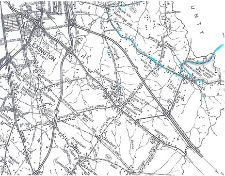
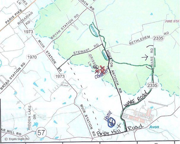
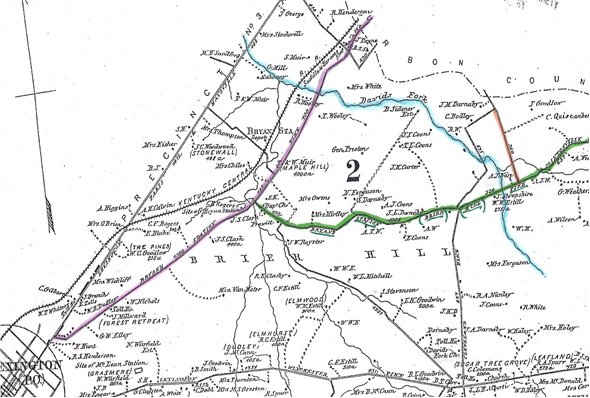
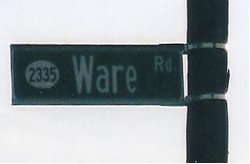
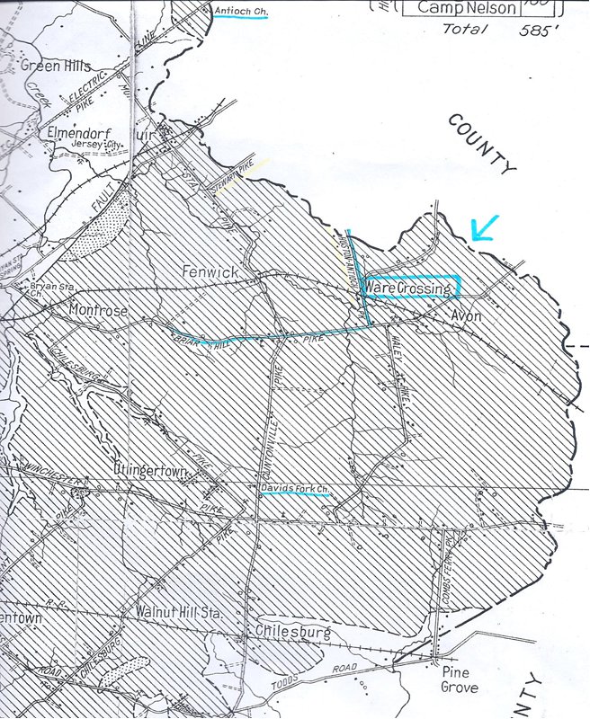
Map showing Ware Road
Maps showing location of James Ware land �
courtesy of the Kentucky Historical Society
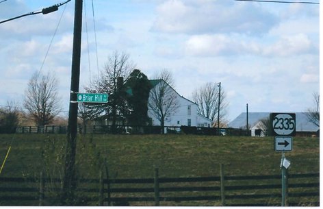
Bryant Station Pike Briar Hill
Pike Ware
James and Caty had a wonderful location for
their property. In his work
entitled, The American Geography,
Jedidiah Morse wrote, in 1794,
the following description of the area: �Elkhorn river, a branch of the Kentucky, from the south-east, waters a country fine beyond description. Indeed, the country east and south of this, including the head waters of Licking river, Hickman's and Jessamine Creeks, and the remarkable bend in Kentucky river, may be called an extensive garden. The soil is deep and black, and the natural growth, large walnuts, honey and black locust, poplar, elm, oak, hickory, sugar tree, &c. Grape vines run to the tops of the trees; and the surface of the ground is covered with clover, blue grass, and wild rye. On this fertile track, and the Licking River, and the head waters of Salt River, are the bulk of the settlements in this country.�
Elkhorn Creek from suspension footbridge, near Frankfort
The Wares found
this land to be perfectly suited for raising good crops and nurturing livestock
that would soon rival the best breeding farms in Virginia. It would not be long before Kentucky
would be known as the epicenter of good horseflesh; a reputation it still
maintains today.
W.G. Stannard, a 19th century author, recorded the following information
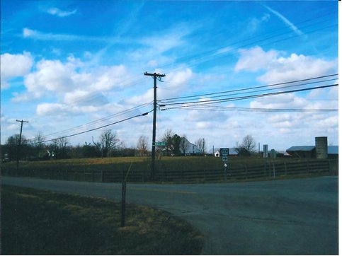
concerning the property location of James: �In 1792, Dr. Ware and the Webb families built three homes on the old Ironworks Pike, just east of the Bryan Station Pike. The Dr. James Ware house still stands at the intersection of the Briar Hill Pike and (new) Antioch Pike. (Ref. 939) With time and growth, the names would change. �The road markers in Fayette County, as of 1998, showed that road as the Houston-Antioch Road and a current map shows the name as Antioch Road, most of it is in Bourbon County.� (Ref. 944)
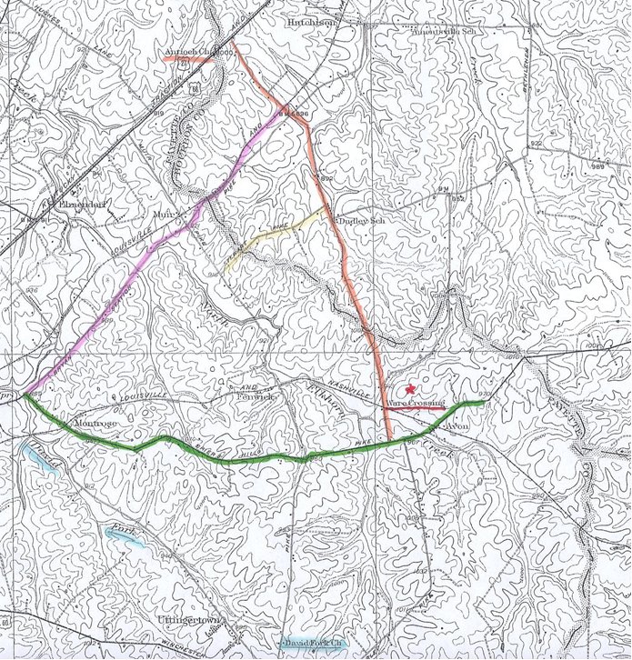
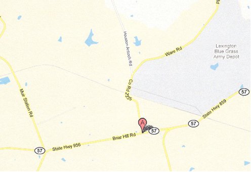
Current Map (as of 2010)
Kentucky Geological Survey Frankfort, KY
W.R. Jillson, Director and State Geologist
Series VI -1926
MAP OF THE AERIAL AND STRUCTURAL GEOLOGY OF FAYETTE COUNTY KENTUCKY �
Reconnaissance Areal Geology by A.C. McFarlan and L.C. Robinson Base source: New
Survey by W.C. Eyl, 1925
Bryant Station Pike
Briar Hill Pike
Ware
Road signs near Ware property �
Photos taken by James and Judy Ware 2010
Since it was �ordered that Abraham Ferguson, Abner
Wilson, Absalom Adams, and Thomas Scott, or any three, be appointed
Commissioners to view a proposed alteration to be made in the road leading from
Bryant�s Station to Hornback�s mill road, through one corner of James Ware�s
land,� that also gives us a hint as to where the property was located.
(Ref. 1044B)
When a death occurred in the
family during those years, most people buried their loved ones in a small
cemetery near their home or on the property itself. As in the case of the Ware and Webb
families during the cholera epidemic, �most
who died then were buried in a small cemetery near the home of Isaac Webb. One
source locates the graveyard as �on Stewart Road.�
(Ref. 934)
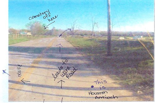
The maps below show the close proximity of Stewart Road to the home of James Ware. As mentioned in the chapter on Lucy
Webb, the cemetery is located on a �road that runs northwesterly to and along a Houston Creek on to where it meets the Lexington-Paris
Pike (the Antioch Church is at the Lexington-Paris Pike juncture, in Bourbon
County, where it is known as the Antioch Pike.)
The road markers in Fayette County now show that road as the
Houston-Antioch Road and a current map shows the name as Antioch Road, most of
it is in Bourbon County.�
(Ref. 944)
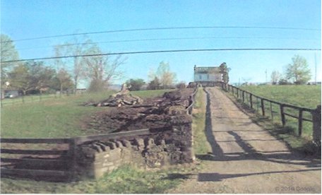
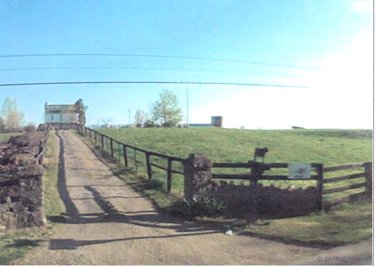
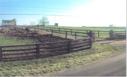
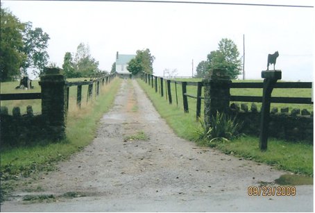
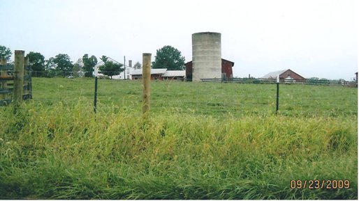
Map showing land belonging to James Ware in Fayette County According to Cornelia Ware Anker, the home of James and Caty Todd Ware was �at first a settlement and some cleared land; the line of Fayette and Bourbon counties ran through their house. This was near Lexington.� (Ref. 2) At the exact �intersection of the Briar Hill Pike and (new) Antioch Pike� there still stands a house today on the property that once belonged to the Wares.
As with all other
property claims that were established by those first Kentucky settlers, the
acreage that was once vast and expansive has been whittled down to just a small
section. Some of the land was sold,
some was inherited, and some subdivided by numerous heirs over the years. Once the property fell out of Ware
ownership, it soon became swallowed up by �progress.� This one portion of land is a lone
bastion holding out against time; a defiant reminder of what once existed. It is frankly amazing that it
still exists - - one definable plot of Kentucky soil that so many Wares walked
on over 200 years ago. If only trees
and soil could talk.
Supporting
Documents for Chapter 12
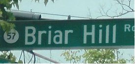
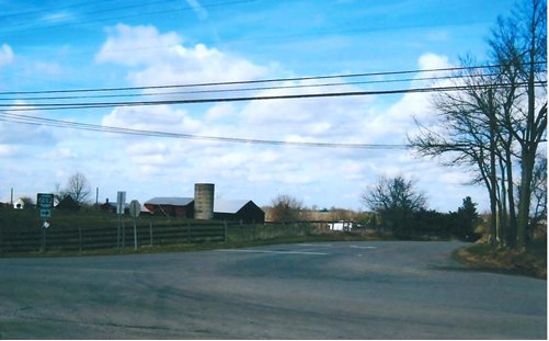
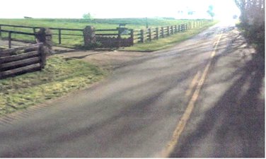
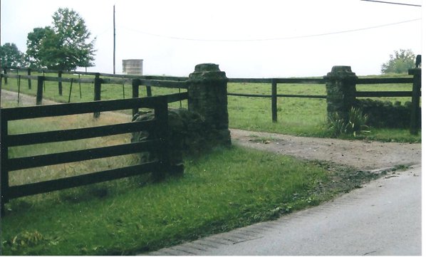
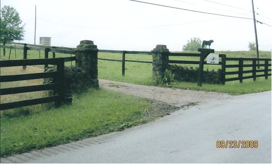
Corner of Briar Hill Road and Houston Antioch (Co. Road 2335)
Corner of Briar Hill and Houston, Antioch
Coming from the opposite direction
Property originally owned
by Caty and James Ware II
Source:
Courtesy of Google Maps
All photos below taken by James & Judy
Ware 2009
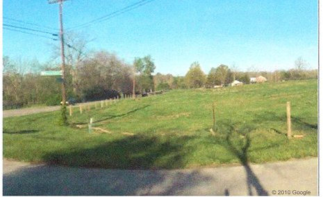
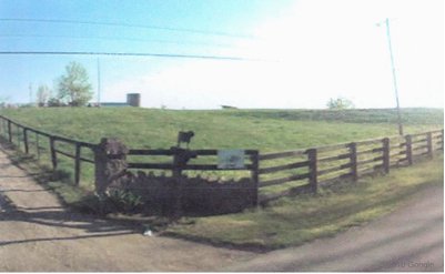
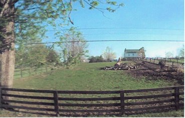
Land purchased by James Ware II in the late 1700s
All photos taken by James & Judy Ware 2009
|
|
Return to Home Page
This site maintained by John
Reagan and last updated |